top of page
Virtual Open House - South & Southeast LA Community Plans
PROPOSED CHANGES
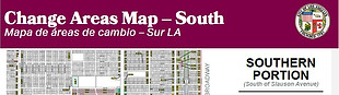
The MAPS below show the locations of the proposed land use and/or zone changes presented in December 2016. Each proposed change area is assigned a number. Areas not colored-in or assigned a number on the map are NOT proposed for any changes. The CHANGE MATRIX is a list of all proposed change areas that provides information on the existing and proposed land use and zoning for each change area.
How to locate your neighborhood or property:
Step 1 - Click on the map and zoom/scroll around to find your neighborhood.
Step 2 - Find the number assigned to the area you are interested in.
Step 3 - Click on the Change Matrix and look for the number on the list.
Maps of the South LA Community Plan
North of Slauson Ave

South of Slauson Ave
Maps of the Southeast LA Community Plan
North of Florence Ave

South of Florence Ave

bottom of page